America's canyon country
The US Southwest is one of the world's great road-trip circuits – a loop through landscapes so otherworldly they feel borrowed from another planet. Red sandstone fins, hoodoos lit orange at dusk, sheer canyon walls 300 metres high, slot canyons barely shoulder-wide. Five national parks, eight campgrounds, and two of the most coveted permits in the US park system.
The route runs east from Las Vegas through Zion and Bryce Canyon, then cuts across Utah's canyon country through Goblin Valley, Arches, and the Needles district of Canyonlands, sweeps down through Monument Valley and Page, and finishes with three nights at the Grand Canyon's South Rim before returning to Las Vegas. It's a genuine wilderness camping trip – no hotels – and the campground booking strategy is as important as the hiking plan.
Late September to October is the ideal window: summer heat has broken (highs 18–25°C in most parks), the light is warm and low, the crowds are a fraction of summer levels, and the cottonwood trees in canyon bottoms begin to turn gold. The Wave lottery and Angels Landing permits are both more achievable outside peak summer months.
Best time for the Southwest loop
Late September–October is the sweet spot: temperatures drop to hiking-friendly levels (18–25°C days, 5–12°C nights – bring a warm layer for camp), the parks are significantly less crowded than summer, and the light quality in the canyons improves as the sun drops lower. The Wave lottery has better odds. Campgrounds are easier to book.
April–May is the spring window: wildflowers in Zion, good temperatures, but summer crowds build fast through May. The Narrows can be flooded with snowmelt in early April.
June–August: temperatures regularly hit 38–42°C in lower elevation parks (Zion, Arches, Monument Valley). Flash flood risk peaks in July–August during monsoon season. Campgrounds book out instantly. The Wave has its worst lottery odds. Not recommended for this itinerary.
Campground guide – book in this order
The campground booking strategy is the most critical part of planning this trip. Devils Garden (Arches) is the hardest reservation in the US national park system – it requires a specific approach. Book campgrounds before you book flights. All Recreation.gov sites open reservations at 8:00am Mountain Time, exactly 6 months before the date.
| Campground | Night(s) | Cost/night | How to book | Availability |
|---|---|---|---|---|
| Watchmen (Zion NP) | Days 1–3 | $20–30 | Recreation.gov · 6 months ahead | Competitive |
| North Campground (Bryce Canyon) | Days 4–5 | $20 | Recreation.gov · 6 months ahead | Moderate |
| Goblin Valley SP | Day 6 | $35 | stateparks.utah.gov | Easier |
| Devils Garden (Arches NP) | Days 7–8 | $25 | Recreation.gov · 8am MT, exactly 6 months out | Extremely hard |
| Wingate (Dead Horse Point SP) | Day 9 | $35–45 | stateparks.utah.gov | Easier |
| Needles (Canyonlands NP) | Days 10–11 | $15 | Recreation.gov · 6 months ahead | Moderate |
| Lone Rock Beach (Glen Canyon) | Day 12 | $30 cash | No reservation – first come, first served | Drive in |
| Mather (Grand Canyon South Rim) | Days 14–15 | $18–35 | Recreation.gov · 6 months ahead | Competitive |
Day by day
Arrive Las Vegas and collect your rental car from the airport. The Strip is 15 minutes from the terminal. Keep the evening low-key – the driving starts tomorrow.
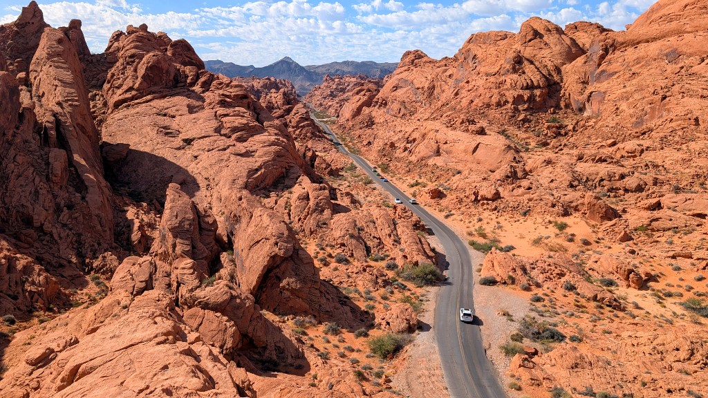
Leave Las Vegas in the morning and take the scenic detour through Valley of Fire State Park – expect a day-use entry fee of about $20 per car at the entrance stations (Nevada state park; confirm the current rate before you go). The park's 40,000 acres of red Aztec sandstone make for a dramatic introduction to the canyon country ahead. Beehive formations, petroglyphs, and Fire Wave trail (2.2 miles, easy) are all worth the stop. Arrive Zion by late afternoon.
Book: Recreation.gov · Opens 8:00am Mountain Time, 6 months before check-in date
Notes: Located at the park entrance near the Zion Canyon Visitor Center. Electric sites include power hookup. Non-electric sites have no hookup but are steps from the shuttle stop. Book the day reservations open – fills within hours in October. Sites have bear boxes; use them.
Angels Landing is one of America's great hikes – a spine of sandstone rising 450m above the Virgin River, with the upper half involving chains bolted into sheer rock. The payoff is a 360° summit view down into the canyon that earns its reputation. The permit system requires starting the chains section after your designated time window.
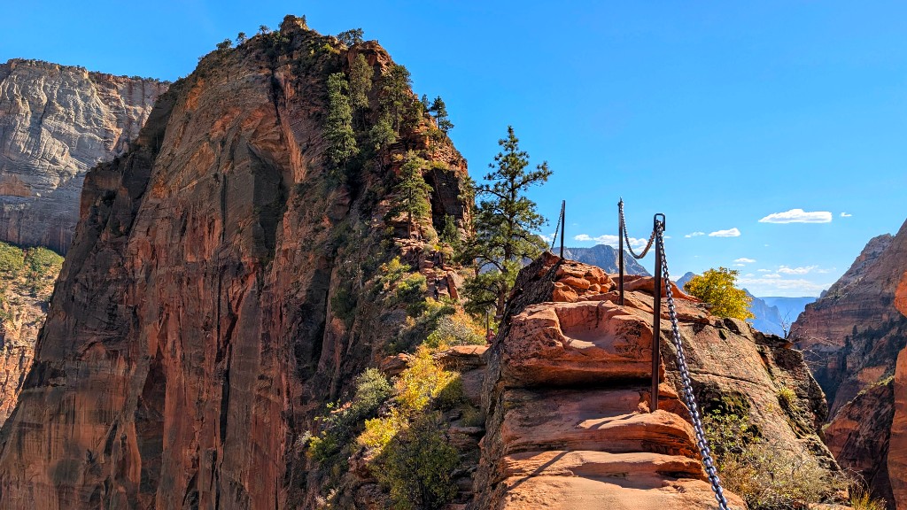
Two lottery types: Advance (seasonal) – opens 3 months before the season on Recreation.gov; and Day-before – opens at midnight the night before on Recreation.gov. The day-before lottery is your most reliable option. Cost: $6 per permit (covers the whole group). Enter both lotteries. If you don't get a permit, the hike to Scout Lookout (below the chains) is permit-free and still excellent.
- Morning: Emerald Pools Lower Trail or Riverside Walk while waiting for permit window
- Early afternoon: Angels Landing – Refrigerator Canyon then Walter's Wiggles switchbacks to Scout Lookout
- Chains section: single-file, take your time, ignore the drop
A single-file queue that moves in bursts – uphill traffic, then downhill traffic, then uphill again. The exposure is real and the chains are genuinely reassuring, but you spend as much time waiting as climbing. The summit view is everything promised. Go mid-week and outside peak hours (before 10:00 or after 14:00 on your permit window) to reduce the queue.
Take the first shuttle to the Temple of Sinawava stop and be wading before the canyon fills with people. The Narrows is Zion's signature experience – walking upstream through the Virgin River between sheer 300m sandstone walls, the canyon narrowing until the river is the trail. Most people wade for an hour or two and turn around, but it's possible to continue all the way to Big Spring (~8km one-way from the trailhead), where the canyon opens briefly and a waterfall marks the limit of day-hiking without a permit. The further in you go, the fewer people you'll see – beyond Orderville Canyon junction it's often just you and the river.
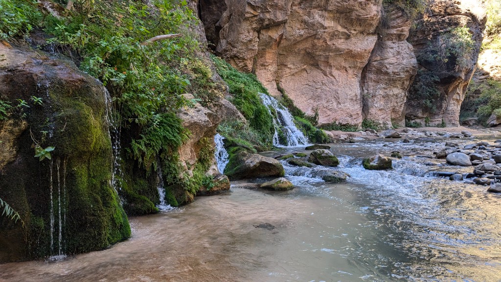
The further we went the more isolated the trail was – we had Big Spring to ourselves!
If you're back from the Narrows by late morning and have legs left, Observation Point is the finest viewpoint in Zion – looking straight down on Angels Landing and the full length of the canyon from 600m above the valley floor. Far less crowded than the Landing, with a strenuous but straightforward trail via Echo Canyon. Only attempt this if you started the Narrows early and finished with energy to spare – it's a big day doubled.
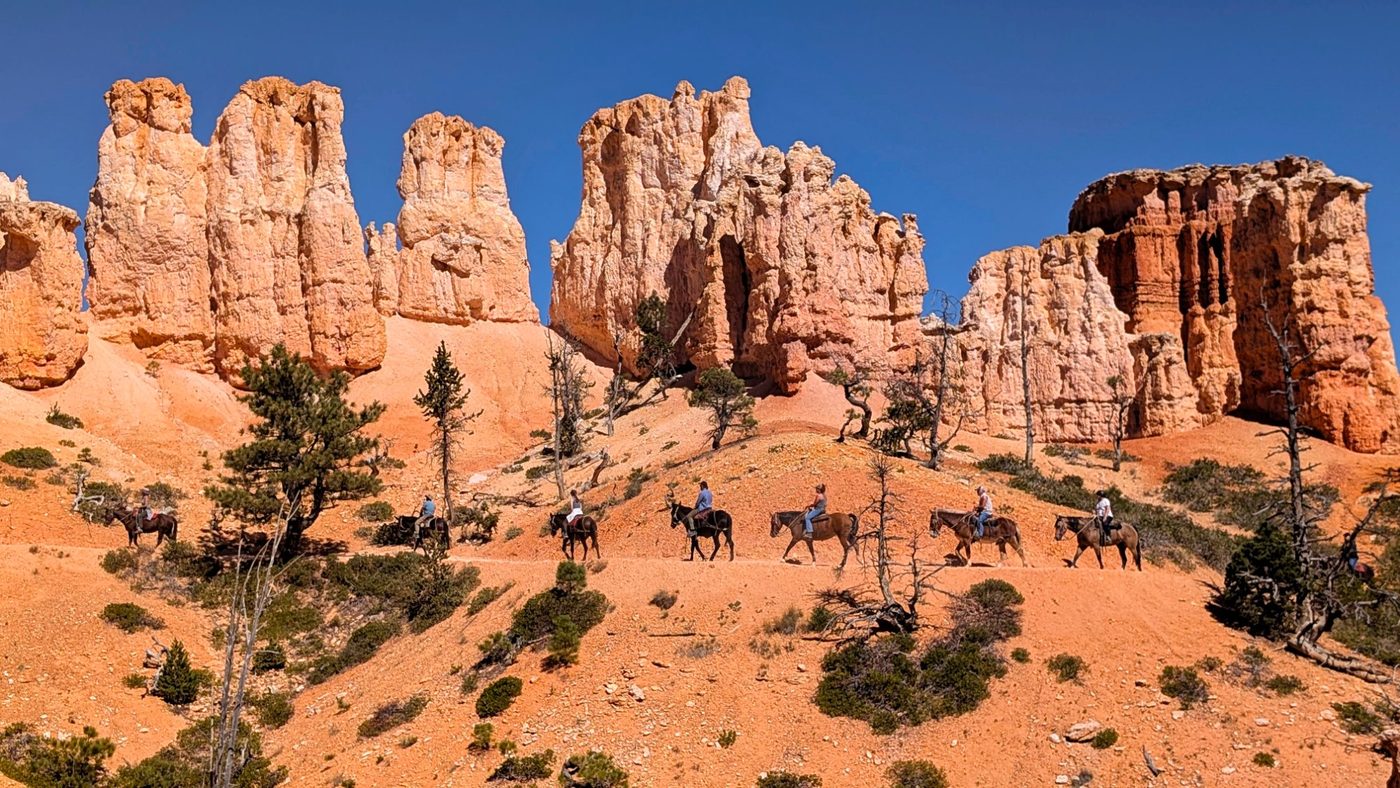
Drive northeast from Zion through the landmark Zion–Mt. Carmel tunnel (fee for oversized vehicles), then up to Bryce Canyon's plateau at 2,400m. Temperatures drop noticeably – pack a layer. The Figure Eight Trail (Queens Garden + Navajo Loop combined, ~8km) in the afternoon gives your first close-up view of the hoodoos at dusk.
Book: Recreation.gov · 6 months ahead at 8am Mountain Time
Notes: Closest campground to the Rim Trail and Bryce Amphitheater overlooks. No hookups in standard sites. At 2,400m elevation, October nights drop below freezing – a 3-season sleeping bag is the minimum. Bring a camp stove; fires may be restricted.
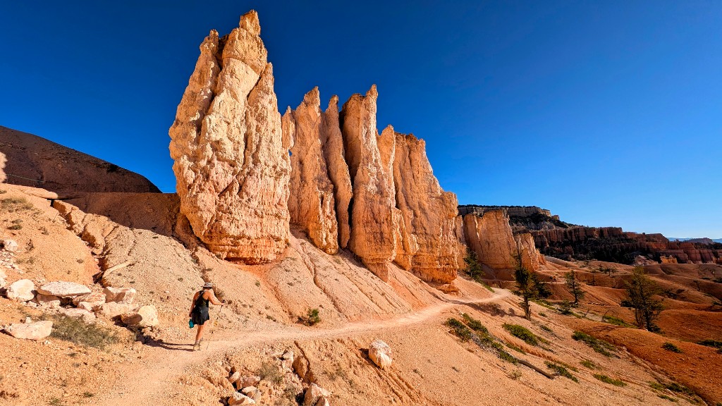
The Fairyland Loop is Bryce's finest full-day hike – a 13km circuit that drops into the hoodoo forest below the rim and stays immersed in the formations for the entire route. Less visited than the Navajo/Queens Garden combination despite being more scenic. Tower Bridge viewpoint halfway is the highlight. Start from Fairyland Point, not the visitor center.
A long drive day but the stops more than justify it. Goosenecks State Park offers one of the most dramatic river-bend overlooks on earth at no cost. Cassidy Arch and Hickman Arch in Capitol Reef are both short but spectacular sandstone formations. Little Wild Horse Canyon is a slot canyon walk that needs no permit and rivals Antelope Canyon for atmosphere. Arrive Goblin Valley by evening.
- Goosenecks State Park – overlook, 5 min from the car park, no entry fee
- Hickman Arch – 3.2km return, 100m gain, Capitol Reef NP ($20 park entry or America the Beautiful pass)
- Little Wild Horse Canyon – slot canyon loop, 13km, 3–4 hrs, no permit, free entry
Book: stateparks.utah.gov · Opens 16 weeks in advance
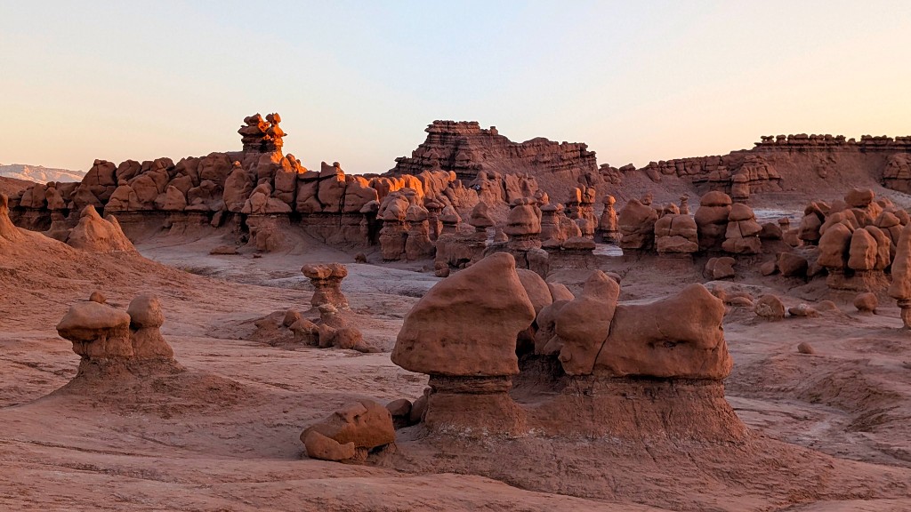
Notes: Electric hookups available. Campsite is surrounded by the goblin formations – spectacular at night under a full sky. Showers available. More accessible than national park campgrounds. 🌌 Dark sky: Goblin Valley sits in one of the darkest corridors in Utah – on a clear moonless night the Milky Way is visible with the naked eye directly above the formations.
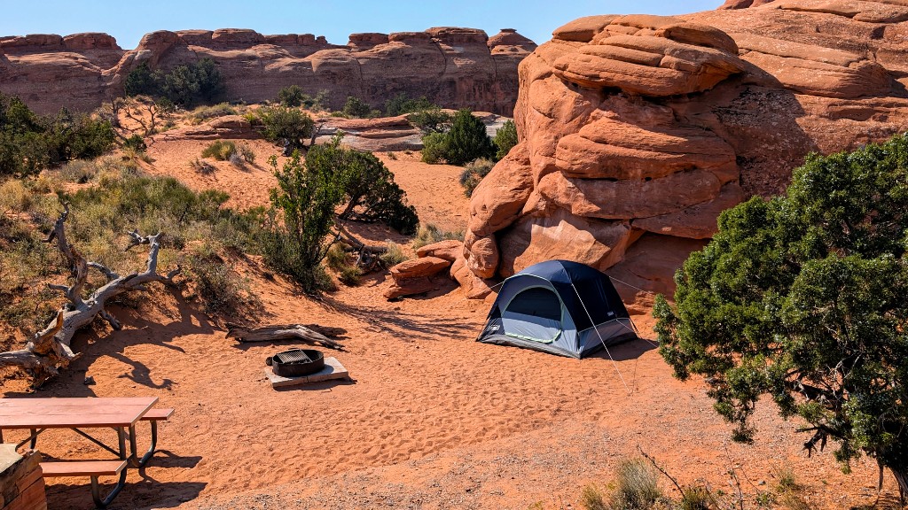
Drive north to Moab, stopping at Corona Arch before entering Arches. Corona Arch (4.8km return, 115m gain) is often called the better arch – larger than Delicate Arch, entirely free-standing, and almost entirely crowd-free by comparison. Arrive at Devils Garden early enough to set up camp before dark.
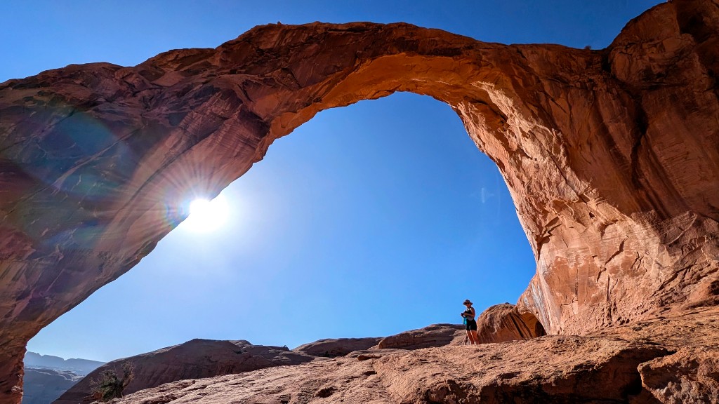
Book: Recreation.gov · 8:00am Mountain Time exactly 6 months in advance – set an alarm
Notes: The most sought-after campground in the US national park system. 51 sites, often gone within 60 seconds of the booking window opening. No hookups. Located at the end of the park road, 20km from the entrance – in the heart of the formations. Bears boxes on site. If you cannot secure this booking, Moab has private campgrounds as a fallback, but the in-park experience is worth every effort.
A full day in Arches – one of the world's greatest concentrations of natural stone arches. The morning belongs to Devils Garden Trail (the longest maintained trail in the park at 12.5km including the primitive loop) and Double Arch. The afternoon builds toward Delicate Arch at sunset – the most iconic image in Utah. Time your arrival at the Delicate Arch trailhead for 90 minutes before sunset.
- Devils Garden Trail – Landscape Arch (largest arch in the park) then Primitive Loop. 12.5km total, allow 4–5 hrs. Start at 08:00.
- Double Arch – 800m from trailhead. Two arches joined at the base. Walk through the frame.
- Fiery Furnace – requires a ranger permit or guided tour ($16). A labyrinthine maze of fins without a marked trail. Book via Recreation.gov if available.
- Delicate Arch at sunset – 4.8km return, 149m gain. Arrive 90 min before sunset. Worth every cliché written about it.
The natural amphitheatre bowl below the arch holds 100–200 people in peak season, all waiting for the same shot. It feels more like a stadium than a wilderness. In late September the crowds thin noticeably – October is better still. The arch itself remains extraordinary. Stand off to one side rather than queuing for the dead-centre shot; the angle from the left rim of the bowl is arguably finer, and you'll have room to breathe.
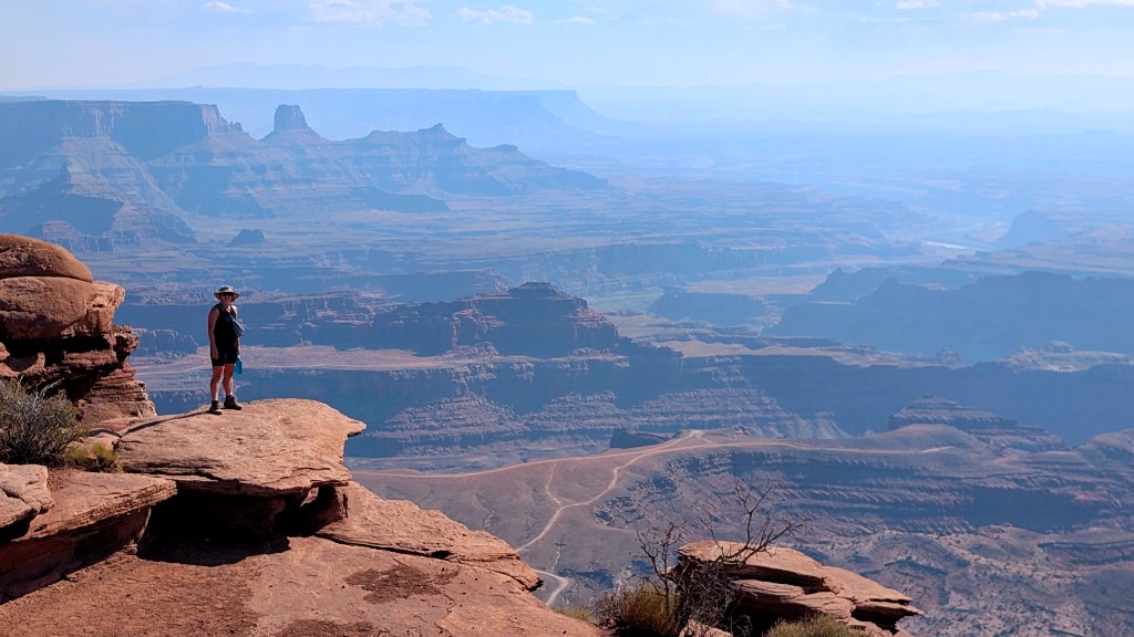
Dead Horse Point State Park sits on a peninsula of rock 600m above the Colorado River – the view rivals the Grand Canyon's South Rim for sheer scale. The Rim Walk circuits the entire mesa (9.6km, flat, easy) with canyon views on both sides throughout. Spend the afternoon here, then check in at nearby Wingate Campground for the night.
Book: stateparks.utah.gov · Opens 16 weeks in advance
Notes: Modern campground with electric hookups, flush toilets, and showers – a good recovery night before Canyonlands. Views from the sites extend across Canyonlands' canyon system. Far easier to book than Devils Garden.
A pre-dawn start for Mesa Arch – the most photographed sunrise in Utah, where the arch frames the canyon below as the sun lights up the underside of the rock in orange and gold. Then drive south to Canyonlands' Needles District – a completely different character from Island in the Sky, with red and white striped fins, arches, and canyon trails extending into a wilderness that rewards going deeper.
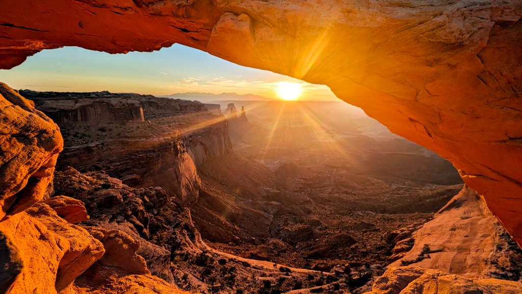
- Mesa Arch – 1.3km loop. Arrive 45 minutes before sunrise. Photographers line the arch; stake out a spot early.
- Needles Visitor Center – pick up trail map and check conditions for Druid Arch / Chesler Park.
Thirty to sixty photographers shoulder-to-shoulder along the arch by 30 minutes before sunrise, tripods touching. Polite jostling for position. Someone's phone torch sweeping the scene. The arch and the light are genuinely spectacular – but you're sharing it. Arrive 45 minutes early, claim your spot, and commit to it. The image is still worth it.
Book: Recreation.gov · 6 months ahead at 8am Mountain Time
Notes: 26 sites inside the Needles district. No hookups, vault toilets only. The most remote national park campground on this route – no mobile signal. Bring all food and water needed. Bear boxes on site. At $15/night it's the cheapest park campground on the trip; book it at the same 6-month window as the others. 🌌 Dark sky: Canyonlands is a certified International Dark Sky Park – the Needles campground has near-zero light pollution and is one of the finest stargazing spots on the entire route.
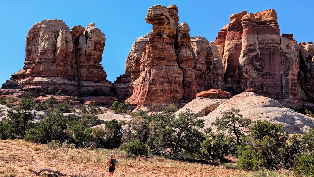
The finest full-day hike of the trip. The Chesler Park Loop combined with Druid Arch makes a 22.5km circuit through the Needles' most dramatic terrain – red and white striped sandstone spires, a hidden grassland meadow (Chesler Park), the Joint Trail threading through a crack barely wide enough for a backpack, and finally Druid Arch – a cathedral-scale natural arch in a remote side canyon. No crowds, no shuttle queues.
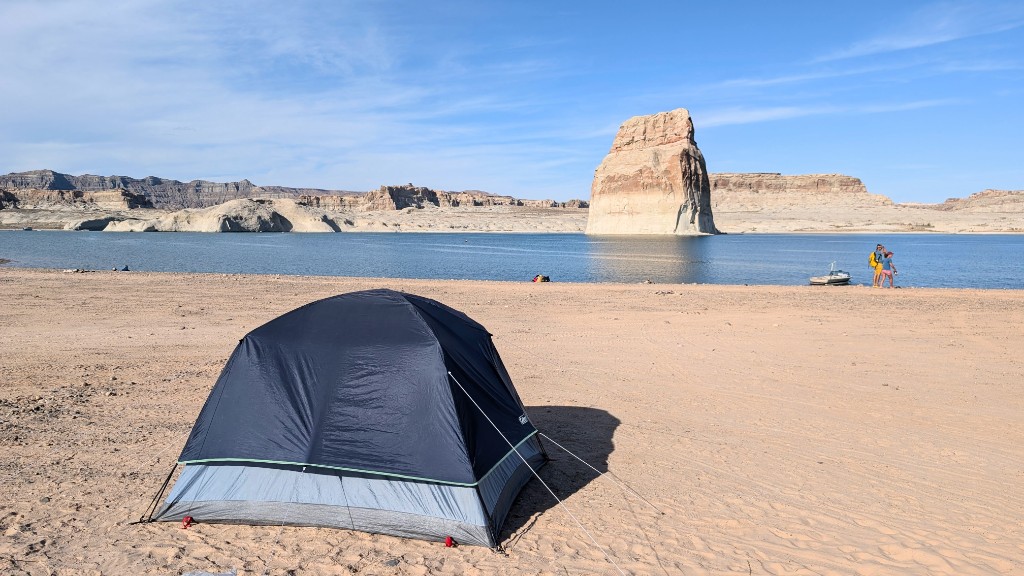
The longest drive day – but Monument Valley at golden hour justifies every mile. The iconic Mittens and Merrick Butte viewpoint from the visitor center is free (the valley drive inside is $20); the red earth road south through the monument is one of the most cinematic drives on earth. Optional en route: Natural Bridges National Monument (see below) adds world-class natural bridges and an easy scenic loop off US-191 near Blanding – skip it if you need every minute for Monument Valley light. End the day at Lone Rock Beach on Lake Powell – a dispersed camping area where you park directly on the sand at the water's edge.
Book: No reservation – first come, first served. Drive in and find a spot.
Notes: Dispersed camping directly on the sand at Lake Powell's edge. Pull your car to within metres of the water. No facilities – pit toilets only. Bring all water and supplies. 🌌 Dark sky: The wide-open horizon over the lake and total absence of nearby towns makes this one of the best Milky Way spots on the route – the reflection off the water on a calm night is extraordinary. In October this is quiet – arrival by 17:00 secures a good spot near the water. Bring cash (exact change preferred, $30).
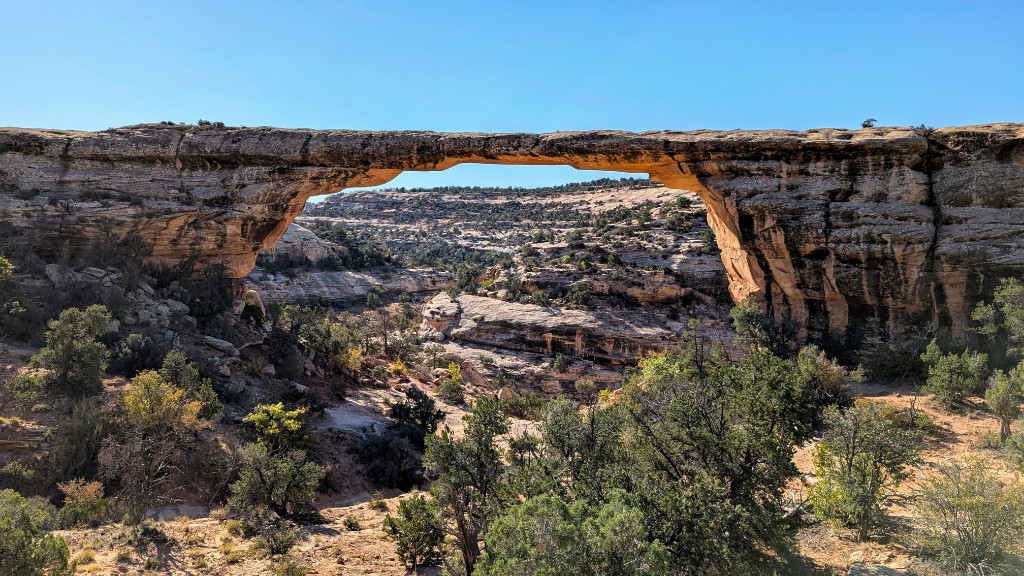
A worthwhile detour west from Blanding on UT-95 – far fewer visitors than the Utah national parks on this trip, with three major natural bridges (including Sipapu, Kachina, and Owachomo) above Cedar Mesa. The paved one-way scenic drive from the visitor center hits overlooks with short walks; you can see a lot in 90 minutes or linger longer. America the Beautiful pass or single-vehicle entry fee applies.
The Wave is one of the most visually extraordinary landscapes in the US – undulating Navajo sandstone in flowing curves of red, pink, and orange, accessible only on foot across open desert. The permit system is intentionally restrictive to protect it. Buckskin Gulch is the world's longest slot canyon and requires no permit – a full-day wading hike into a canyon that narrows to less than a metre in places.
Only 64 people per day are permitted. Two lottery systems: Advance lottery (online at recreation.gov, opens 4 months before the date, $9 application fee, $7 per person if selected) and Day-before lottery (also on Recreation.gov, midnight the night before, same fees). The advance lottery is highly competitive; the day-before lottery requires flexibility. Plan a buffer day if The Wave is a priority. If you don't win the lottery, Buckskin Gulch alone is a worthy full day.
Unfortunately we didn't get permits for The Wave but we did a great hike called Cathedral Wash.
A final morning in Page – Horseshoe Bend is a 270° meander of the Colorado River seen from a 300m cliff edge, a 2.4km return walk from the car park ($10 parking fee). An optional boat trip on Lake Powell or the Colorado covers the canyon from river level before the drive to Grand Canyon's South Rim.
Book: Recreation.gov · 6 months ahead at 8am Mountain Time
Notes: The South Rim's main campground, 1km from the village. Standard, accessible, and tent-only sites available. Flush toilets and pay showers nearby. October nights drop to near freezing – 3-season sleeping bag essential. The campground is a 10-minute walk from the Rim Trail and village shuttle stops.
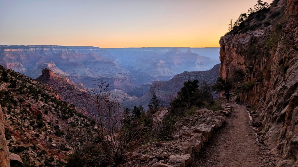
Bright Angel is the Grand Canyon's most famous trail – descending from the South Rim (2,100m) to the Colorado River (760m) over 14.5km one-way. Most day hikers turn around at 1.5-mile resthouse (3km, 290m descent), 3-mile resthouse (5km, 470m descent), or Indian Garden (7.5km, 910m descent). Going to the river and back is a 29km, 1,400m effort recommended only for early starters with significant reserves. Remember: every metre down is a metre back up, in afternoon heat.
Break camp, drive west on I-40 and then northwest on US-93 to Las Vegas. Allow 4 hours without stops – more if you're flying and need buffer time. Return the rental car at LAS and fly home.
What to know before you go
🎫 America the Beautiful Pass
The $80 America the Beautiful annual pass covers entrance fees at all US national parks and federal lands – this trip visits Zion, Bryce Canyon, Arches, Canyonlands, and Grand Canyon, each charging $30–$35 per vehicle entry. The pass pays for itself on day two of the trip. Buy online at store.usgs.gov or at the first park entrance.
🚗 Rental Car
A standard 4-door sedan or small SUV is sufficient – no 4WD required on this route. All campgrounds and trailheads are paved. Book an automatic well ahead. Pick up at LAS airport (multiple agencies in the terminal). A full-size tank of gas lasts 3–4 days of driving.
🛏 Camping Gear
A 3-season sleeping bag rated to -5°C is the minimum for late September – October. Bryce Canyon and the Grand Canyon South Rim regularly drop below freezing at night. A freestanding tent, a camp stove, and two large water containers are essential. Bears are present at Zion, Bryce, and the Grand Canyon – use bear boxes at every site.
💧 Water & Food
Needles Campground and Lone Rock Beach have no potable water – carry a 10L container and fill at previous campgrounds or in Moab. Most other campgrounds have water on site. Food: stock up in Moab before Needles (last real grocery store for 2 days). Page (AZ) is the last town before the Grand Canyon with a full supermarket.
📶 Connectivity
Mobile signal is absent for much of this trip – no signal inside Canyonlands, minimal in Bryce. Download offline maps (Maps.me or Google offline maps) for every park before arrival. Recreation.gov, permit results, and weather forecasts should be checked in towns (Moab, Page, Springdale) with wifi. Don't rely on data for navigation inside the parks.
🌌 Dark Sky Parks
Several parks on this route are designated International Dark Sky Parks – some of the darkest skies in North America. Bryce Canyon, Canyonlands, Capitol Reef, and Arches all hold the designation, and Goblin Valley and Dead Horse Point State Park are exceptional too. On a clear moonless night you can expect the full Milky Way core with naked eye visibility. Check moon phase before you go – a new moon window aligned with your trip is worth planning around. Bring a red-light headlamp to preserve night vision at camp.
💵 Cash
Carry $150–200 in cash for the trip. Lone Rock Beach is cash-only ($30). Monument Valley Navajo tribal park charges $20 cash or card. Some roadside stands and smaller visitor facilities are cash-only. ATMs are available in Springdale (Zion), Moab, and Page – there are no ATMs inside any of the parks.