Coast, desert, and high sierra
California packs more geographic extremes into a single state than most countries manage across their entire landmass. This 18-day road trip bases on the Pacific coast at Monterey for two nights – with a full Day 1 out-and-back through Big Sur – then drops into the ancient sequoia groves of the Sierra Nevada, swings south through Los Angeles and into the Mojave Desert at Joshua Tree, crosses the lowest point in North America at Death Valley's Badwater Basin, then climbs to the highest peak in the contiguous United States at Mount Whitney – all within three days of driving. The second half threads through the Eastern Sierra's alpine lakes, spends three nights in Yosemite Valley, and finishes at the volcanic caves and condor habitat of Pinnacles before returning to San Francisco.
The route is a mix of campgrounds and accommodation. Twelve of seventeen nights are spent in campgrounds; the remaining five – two in Monterey, two in Los Angeles, and one in Lone Pine – use hotels or motels that serve as recovery points with showers, laundry, and real beds between wilderness stretches.
Late June to early July is the target window for this specific itinerary: the Eastern Sierra trails and high passes are clear of snow, Yosemite's waterfalls still carry spring volume, Death Valley is survivable in the early morning, and Whitney permits are active. Earlier in the season risks snow on high passes; later means dry waterfalls and brutal desert heat.
Route map
Best time for the California loop
June–September is the core window: the Eastern Sierra's high passes and trails are snow-free, Whitney permits are active, Yosemite's Tioga Road is open, and campground booking windows align. Late June offers the best Yosemite waterfall volume; September brings cooler desert temperatures and thinner crowds.
May and October are shoulder months: some high-elevation trails may still have snow (May) or early closures (October). Tioga Road typically opens late May and closes mid-October. Death Valley is significantly cooler and more comfortable in these months.
November–March: Tioga Road and most Eastern Sierra passes are closed. Whitney Trail may require winter gear and crampons. Joshua Tree and Death Valley are at their best (mild temperatures, fewer crowds), but this itinerary as written requires summer access to the high sierra.
Campground guide – book in this order
The campground booking strategy is critical. Upper Pines (Yosemite) is the hardest reservation on this route – it sells out within minutes of the booking window opening. Book campgrounds before you book flights. Yosemite sites open 5 months ahead on the 15th of each month at 7:00am Pacific Time. Most other Recreation.gov campgrounds open 6 months ahead.
| Campground | Night(s) | Cost/night | How to book | Availability |
|---|---|---|---|---|
| Lodgepole (Sequoia NP) | Day 2 | $22 | Recreation.gov · 6 months ahead | Competitive |
| Jumbo Rocks (Joshua Tree NP) | Days 5–6 | $20 | Recreation.gov · 6 months ahead | Moderate |
| Big Pine Creek (Inyo NF) | Days 8–9 | $28 | Recreation.gov · 6 months ahead | Easier |
| Twin Lakes (Mammoth / Inyo NF) | Days 10–11 | $28–29 | Recreation.gov · 6 months ahead | Moderate |
| Upper Pines (Yosemite NP) | Days 12–14 | $26 | Recreation.gov · 7am PT, 15th of month, 5 months ahead | Extremely hard |
| Pinnacles (Pinnacles NP) | Days 15–16 | $36 | Recreation.gov · 6 months ahead | Easier |
If you don't get a camp spot, fear not – you can set an alert on Recreation.gov to be notified when someone cancels for your dates. We successfully did this for Upper Pines at Yosemite.
Day by day
Arrive San Francisco and collect your rental car from the airport, then head straight south – you're leaving the Bay Area tonight. US-101 or I-280 to Highway 1 brings you down the peninsula and along the bay toward Monterey in roughly two to two and a half hours without stops. If you land with time to spare, a short detour through Santa Cruz or a coffee stop in Monterey's Cannery Row works; save Big Sur itself for tomorrow.
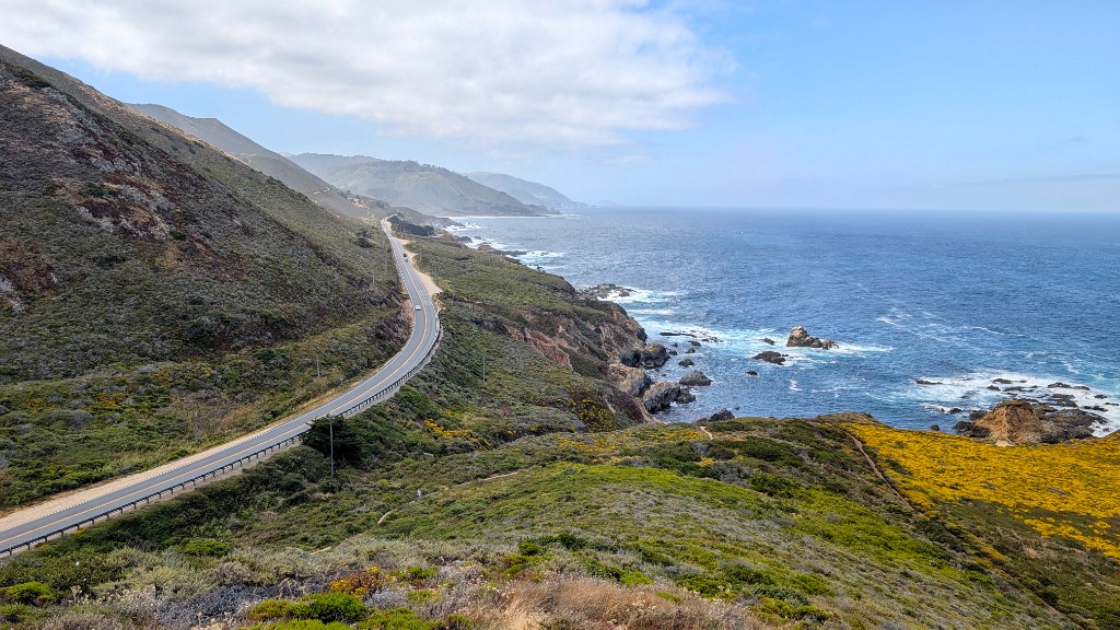
Treat today as a full day on Highway 1 south of Monterey – 150 kilometres of winding cliffside road above the Pacific, then the same road back to your motel. Stop at Point Lobos State Natural Reserve (short coastal walks and tidepools), Bixby Bridge (the most photographed bridge in California), McWay Falls (an 80-foot waterfall that drops directly onto a beach cove), and Pfeiffer Beach for the iconic Keyhole Arch at sunset. How far south you push – toward Gorda or Ragged Point – depends on pace; either way you return to Monterey for a second night.
- Point Lobos State Natural Reserve – short coastal walks and tidepools. Arrive early for parking.
- Bixby Bridge – pull-off on the north side for the classic shot. Arrive early to avoid parking chaos.
- McWay Falls – 5-minute walk from the car park to the overlook. No beach access (closed).
- Pfeiffer Beach – narrow access road, $12 day use fee. Purple sand and the Keyhole Arch at sunset.
Drive inland from Monterey to Sequoia National Park. The General Sherman Tree – the largest living tree on Earth by volume – is a 30-minute walk from the Lodgepole area. The Congress Trail loop (3.2km, easy, paved) connects Sherman to several other giant sequoias and is the park's essential walk. Set up camp at Lodgepole and spend the afternoon in the grove as the crowds thin out.
- General Sherman Tree – 275 feet tall, 36 feet diameter at base. The short walk down from the parking area is steep on return.
- Congress Trail – 3.2km paved loop through the Giant Forest. Flat, easy, wheelchair-accessible in parts.
- Moro Rock – 400-step staircase to a granite dome summit with 360° views of the Great Western Divide. 20 minutes up.
Book: Recreation.gov · 6 months ahead
Notes: Located at 6,700 feet near the Giant Forest. Flush toilets, drinking water, and a camp store nearby. Bears are active, use the bear boxes at every site. Evening temperatures at this elevation drop to 5–10°C even in summer.
This was by far our coldest night camping, wrap up for bed!
Start early for the Pear Lake hike – the finest day hike in Sequoia. The trail climbs through giant sequoia forest, crosses the Tableland plateau, and ends at a pristine alpine lake set in a granite cirque at 2,900m. It's a challenging out-and-back with real elevation gain, so carry plenty of water and start by 07:00. After the hike, break camp and drive south to Los Angeles – a long day, but the evening reward is a shower, a proper meal, and a real bed.
A rest day in LA before the desert stretch ahead. The Griffith Observatory gives the best free panorama of the city (and the Hollywood sign); Santa Monica Pier and Venice Beach are the classic oceanfront walk. The Getty Center is world-class and free (parking $20). Use this day to do laundry, stock up on supplies for the desert, and eat well – the next campground has no water.
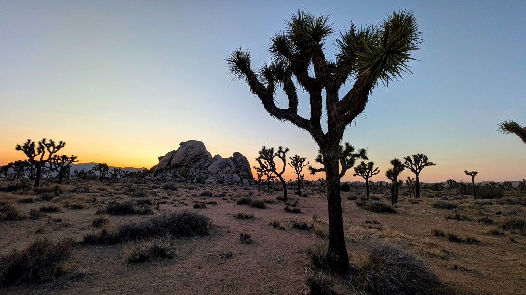
Drive east from LA into the Mojave Desert. Joshua Tree's landscape is surreal – vast fields of the park's namesake trees set among enormous rounded granite boulders that look stacked by giants. Arrive by early afternoon to set up camp at Jumbo Rocks, then explore the Skull Rock Trail (2.5km loop) and Arch Rock (short walk from White Tank campground) before sunset. The golden hour light on the boulders is extraordinary.
Book: Recreation.gov · 6 months ahead
Notes: 124 sites set among the signature boulder formations. No water, no hookups – bring all water you need (minimum 4 litres per person per day). Vault toilets only. Camp store in Twentynine Palms (30 min drive). The boulders provide natural wind shelter and shade. 🌌 Dark sky: Joshua Tree is an International Dark Sky Park – the Milky Way is visible with the naked eye on a moonless night. Bring a red-light headlamp.
A full day exploring Joshua Tree. Start with Ryan Mountain (4.8km return, 300m gain) for the best summit panorama in the park – 360° views across the Mojave and Colorado Desert junction. Drive south to Keys View for a clear-day vista stretching to the Salton Sea, then walk the Cholla Cactus Garden (short boardwalk through a dense forest of teddy-bear chollas – don't touch them). Finish with sunset from Cap Rock or Skull Rock.
- Ryan Mountain – 4.8km return, 300m gain. Best summit view in the park. Start early to avoid midday heat. Carry 2L minimum.
- Keys View – drive-up viewpoint. On a clear day you can see the Salton Sea, Palm Springs, and Mexico.
- Cholla Cactus Garden – 400m boardwalk. Best in morning light when the spines glow. Don't touch – the segments detach and embed.
- Hidden Valley – 1.6km loop through a boulder-enclosed valley. Easy, atmospheric, and good for shade in the afternoon.
The longest drive day – but Death Valley's highlights justify every mile. Badwater Basin is the lowest point in North America (86m below sea level) where you can walk out onto a vast salt flat that stretches to the horizon. Zabriskie Point offers the most photographed eroded badlands in the American West. The Mesquite Flat Sand Dunes are the classic Sahara-style dunes – best at golden hour. Drive north out of the valley toward Lone Pine as the sun sets behind the Sierra Nevada.
- Badwater Basin – walk 1.5km onto the salt flat. The view from the car park doesn't convey the scale – you need to be out on it.
- Zabriskie Point – 2 minutes from car park to overlook. Best at sunrise or late afternoon light.
- Mesquite Flat Sand Dunes – no marked trail, walk toward the tallest dune (~30m). 2km each way. Best in the last hour before sunset.
The heat here was extreme, getting out the car was an experience!
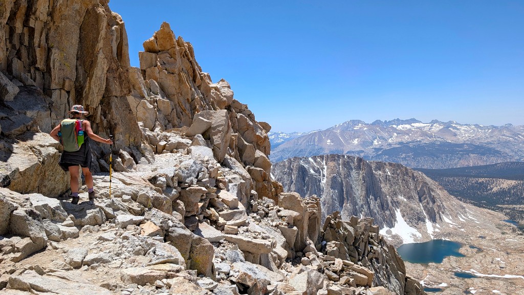
Mount Whitney is the highest peak in the contiguous United States at 4,421m – and the day-hike from Whitney Portal to the summit and back is one of the most demanding single-day hikes in the country. 35km with 1,900m of elevation gain, most of it above 3,500m where the air thins noticeably. Start before dawn (02:00–04:00) to summit by midday and avoid afternoon thunderstorms. The 97 switchbacks up the final headwall are relentless, but the summit views extend across the entire Sierra Nevada and east into the Nevada desert.
Lottery: Applications open in February on Recreation.gov and close March 1. Results announced mid-March. Cost: $15/person recreation fee + $6 reservation fee. ~100 day-hike permits issued daily during quota season (May 1 – November 1). If you don't win the lottery, unclaimed permits become available first-come, first-served from April 22 onward – check Recreation.gov daily for cancellations.
This hike is no joke – prepare for a long day. We were fighting with the altitude towards the top.
Book: Recreation.gov · 6 months ahead
Notes: Set at 7,700 feet in Big Pine Canyon along the creek. Vault toilets, no potable water – bring your own or treat creek water. Some sites have creek frontage. The campground is the trailhead for the Big Pine Lakes trail (Day 10). Bears are present – use bear canisters or provided boxes.
A deliberate rest day after Whitney. The Alabama Hills are a landscape of weathered granite arches, boulders, and fins at the base of the Sierra Nevada, used as a filming location for over a hundred Hollywood westerns and sci-fi films. Drive the Movie Flat Road loop, walk to Mobius Arch (short trail, the arch frames Mount Whitney through its opening), and explore the surreal rock formations at your own pace. The light at sunrise and sunset is extraordinary – the Sierra Nevada glows pink and orange behind the foreground boulders.
- Mobius Arch – 800m loop trail. The arch frames Mt. Whitney in its opening. Best photographed at sunrise.
- Movie Flat Road – unpaved loop through the heart of the formations. 2WD-accessible in dry conditions.
- Lone Pine Peak viewpoint – multiple pull-offs along the road with the Sierra Nevada as a backdrop.
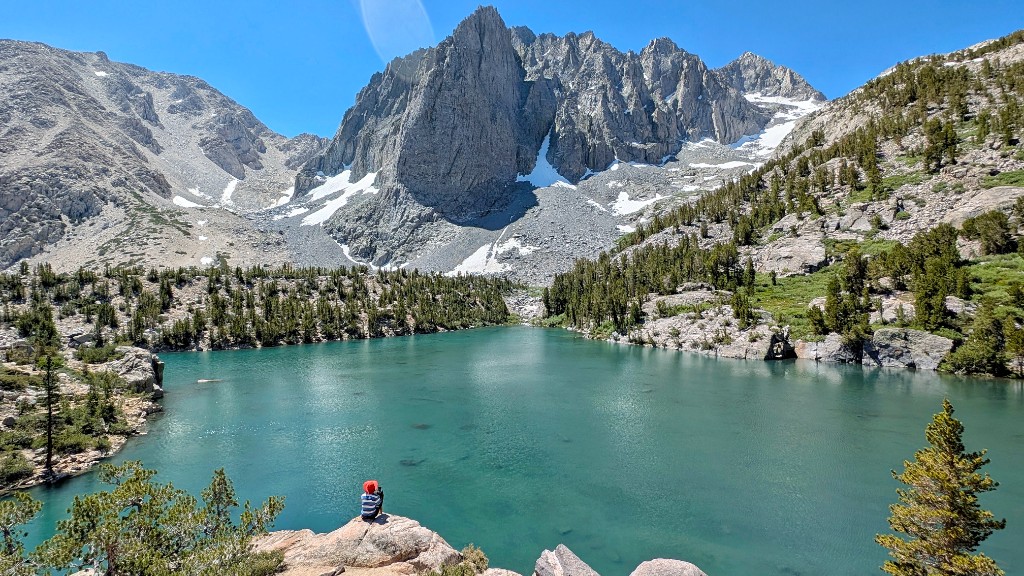
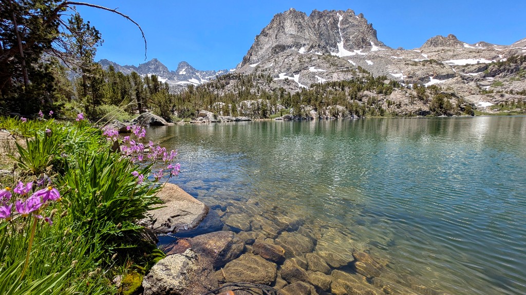
The Big Pine Lakes trail climbs from the campground into the Palisade Glacier basin – the southernmost glacier in the United States. First Lake and Second Lake are the highlights: vivid turquoise alpine lakes set beneath the Palisade Crest at over 3,000m. The colour comes from glacial flour suspended in the water. Hike out-and-back to Second Lake (16km return, 750m gain, 5–7 hrs), then break camp and drive north to Twin Lakes Campground near Mammoth Lakes for the Eastern Sierra hikes ahead.
Book: Recreation.gov · 6 months ahead
Notes: 93 sites at 8,600 feet elevation near Mammoth Lakes. Flush toilets, drinking water, camp store with paid showers and boat rentals nearby. Set on the shore of Twin Lakes with views of the surrounding peaks. Open late May to early October. The campground is within driving distance of the Agnew Meadows trailhead for the Shadow/Ediza hike tomorrow.
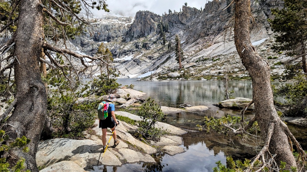
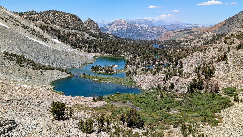
One of the finest day hikes in the Sierra Nevada. The trail from Agnew Meadows climbs through forest to Shadow Lake – a dark, mirror-still lake beneath the Minarets – then continues to Lake Ediza in a dramatic granite cirque with the jagged Minarets towering above. If you have energy, push further to Iceberg Lake where chunks of ice float in the water well into summer. The total round trip to Iceberg Lake is roughly 24km with 900m of gain – a full day, but the alpine scenery is among the best in California.
Day-use permits for this trail are available as walk-up at the trailhead – no reservation needed for day hikes. However, the Reds Meadow Road (required to reach Agnew Meadows) may require a shuttle or have road construction restrictions in 2026 – check the Inyo National Forest website before your visit. The Shadow Creek trailhead has a daily quota of 30 people for overnight use. Day hikers are not subject to the overnight quota.
A morning hike over Duck Pass to Duck Lake – another stunning Eastern Sierra alpine lake, this one set at 3,100m with panoramic views of the Mammoth Crest. The trail climbs steadily through forest and meadow, passing Barney Lake before cresting the pass at 3,120m. Duck Lake is just beyond. Return the same way, break camp at Twin Lakes, then drive west through Tioga Pass (the highest road pass in the Sierra at 3,031m) and down into Yosemite Valley – one of the great entrances to any national park on earth.
Book: Recreation.gov · 7:00am Pacific Time on the 15th of the month, 5 months in advance – set an alarm
Notes: 238 sites in Yosemite Valley at 4,000 feet. Flush toilets, drinking water, food storage lockers (mandatory – bears are active). Steps from the Mist Trail and Half Dome trailheads. 7-day camping limit May–September. The most sought-after campground in the California park system – sells out in under a minute. If unavailable, check North Pines or Lower Pines as alternatives, or Crane Flat (outside the valley).
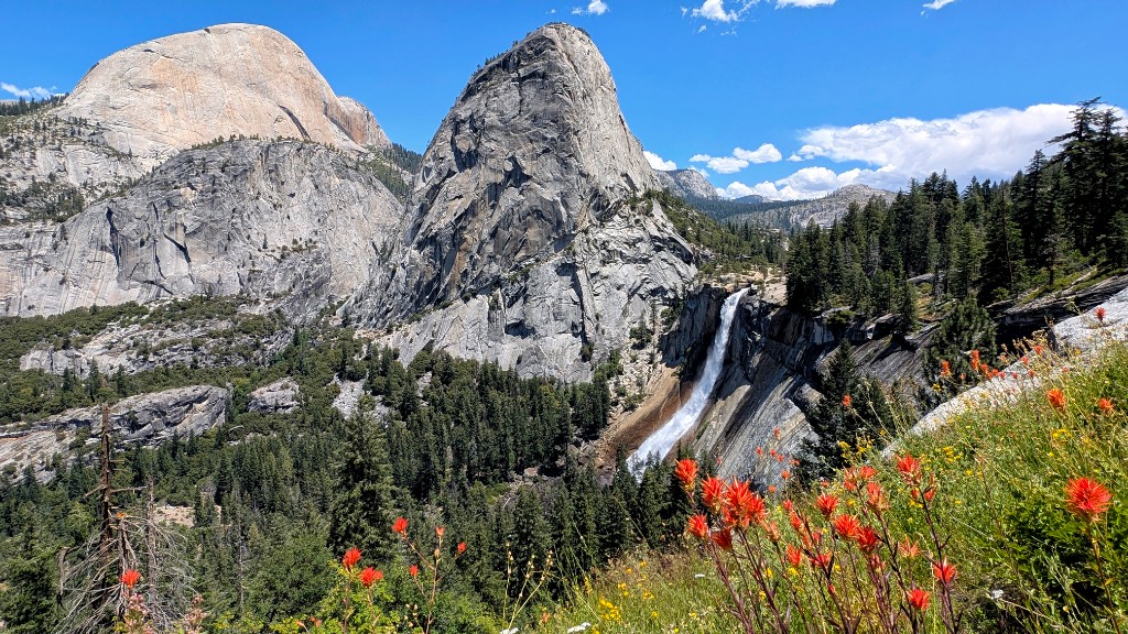
If you won the Half Dome daily lottery, today is the day. The hike from Happy Isles to the summit of Half Dome is 23km with 1,450m of elevation gain – the final 120m up the cables section on the steep granite face is the most exposed and exhilarating stretch. Start at dawn, summit by midday, and descend before afternoon thunderstorms. If you didn't get a Half Dome permit, the Mist Trail to Vernal Fall (96m) and Nevada Fall (180m) is a world-class hike in its own right – arguably the finest waterfall trail in the US.
Apply two days before your intended hike date via Recreation.gov (12:00am – 4:00pm Pacific Time). 50 permits issued daily through the lottery. $10 application fee (non-refundable) + $10/person if selected. Daily odds range from 5–20% depending on the date. A pre-season lottery (March 1–31) is also available as a backup – results announced mid-April. The cables are typically up from late May to mid-October.
- Half Dome (with permit) – 23km return from Happy Isles via Mist Trail, Sub Dome, and the cables. 10–14 hrs. Start by 06:00. Carry 3L+ water and gloves for the cables.
- Mist Trail (no permit needed) – Vernal Fall bridge (1.6km), top of Vernal Fall (4km), top of Nevada Fall (9km return). The mist from Vernal Fall will drench you – bring a rain layer or embrace it.
The cables are a queue. In peak season, 20–40 people share the cables at any given time, ascending and descending on the same pair of steel cables bolted into granite at a 45° angle. The drop beneath you is real and unprotected – 600m of sheer granite on both sides. Gloves are essential (the cables will shred bare skin). The summit itself is surprisingly large and flat, with room to spread out and eat lunch while looking across the entire valley. The view justifies the ordeal.
Two options for the final full day in Yosemite. The Upper Yosemite Falls trail climbs 820m via relentless switchbacks to the top of the tallest waterfall in North America (739m total drop) – the view from the top, looking down into the valley with Half Dome across the way, is one of the park's finest. Alternatively (or additionally, for strong hikers), North Dome offers the best head-on view of Half Dome from across the valley – a less-visited trail that rewards with a quieter, more contemplative perspective.
- Upper Yosemite Falls – 11.6km return, 820m gain from Yosemite Falls trailhead (Camp 4). Allow 6–8 hrs. The switchbacks are exposed – start early.
- North Dome – 14.5km return from Yosemite Falls trailhead via Yosemite Point, or shorter approach from Tioga Road (Porcupine Creek trailhead, 12km return). The view of Half Dome from North Dome is the definitive perspective.
Break camp in Yosemite Valley and drive west, then south to Pinnacles – California's most underrated national park. The landscape is the eroded remains of an ancient volcano, split in half by the San Andreas Fault and moved 200 miles from its origin. Talus caves, towering rock spires, and one of the only California condor reintroduction sites in the world. Arrive by late afternoon and set up camp for two nights.
Book: Recreation.gov · 6 months ahead
Notes: The only campground in Pinnacles NP, located near the east entrance. 134 sites with flush toilets, drinking water, and a camp store. Some sites have shade from oak trees – request one if possible. The pool (seasonal) is a welcome luxury after two weeks of camping. Easier to book than Yosemite – weeknight availability is usually good.
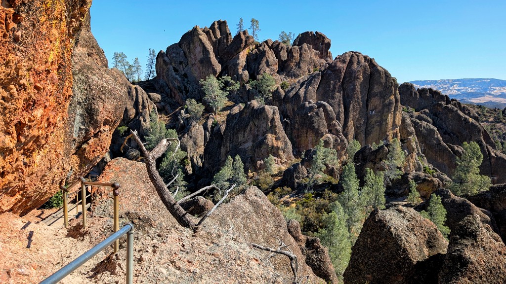
The defining loop in Pinnacles – and one of the most unique hiking experiences in California. The route climbs via Condor Gulch to the High Peaks, where the trail threads through volcanic spires via steep staircases, hand-carved narrow passages, and handrail-equipped ledges with condors often soaring at eye level. The descent via Old Pinnacles Trail drops through a quieter, more forested canyon before looping back. It's strenuous but compact – the entire park's highlights packed into a single morning.
- Condor Gulch → High Peaks – start from the Bear Gulch Visitor Center. The Condor Gulch ascent is the steeper direction – tackle the elevation gain on fresh legs. Ladders and narrow rock squeezes on the High Peaks section.
- Old Pinnacles Trail – the descent leg. A gentler, shaded canyon trail through the heart of the volcanic formations. Quieter than the High Peaks section.
- Bear Gulch Cave – add this as a side trip on return. Talus cave requiring a headlamp – scrambling through boulder gaps in darkness. Open seasonally (check for bat closures).
- California condors – look for the tags on their wings. The High Peaks section is the best viewing area. Wingspan up to 2.9m – you'll see them soaring below you from the ridge.
Pinnacles is the least-visited national park in California, and it shows in the best possible way. The trails are quiet, the caves feel genuinely adventurous (not a curated show cave – you're scrambling through boulder gaps with a headlamp), and the condor sightings are thrillingly close. The park is small enough that you can cover all the highlights in a day without feeling rushed. The heat in summer is the only catch – above 35°C, the exposed High Peaks trail becomes brutal. Start by 07:00.
Break camp, drive north to San Francisco, return the rental car at SFO, and fly home. Allow 3 hours for the drive without stops – more if your flight is in the morning or you want a final stop in the city. The route passes through Gilroy (garlic capital of the world, if you want a souvenir) and up through Silicon Valley before reaching the airport.
What to know before you go
🎫 America the Beautiful Pass
The $80 annual pass covers entrance fees at all US national parks and federal lands. This trip visits Sequoia ($35), Joshua Tree ($30), Death Valley ($30), Yosemite ($35), and Pinnacles ($30) – the pass pays for itself by the third park. Buy online at store.usgs.gov or at the first park entrance.
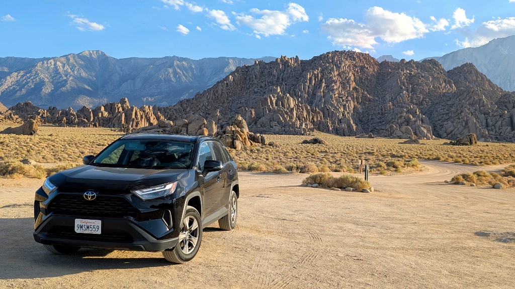
🚗 Rental Car
A standard 2WD sedan or small SUV is sufficient for the entire route – all roads are paved. Book an automatic with good air conditioning (essential for Death Valley and Joshua Tree). Pick up and drop off at SFO. Fill up in towns – fuel stations are scarce in Death Valley and the Eastern Sierra.
🛏 Camping Gear
A 3-season sleeping bag rated to -5°C covers the range – Eastern Sierra campgrounds at 2,400–2,600m can drop to 0°C at night even in summer, while desert sites stay warm. A freestanding tent, camp stove, and bear canister (required in Yosemite, recommended in Sequoia and Inyo NF) are essential.
💧 Water
Jumbo Rocks (Joshua Tree) and Big Pine Creek have no potable water. Carry a 10–15 litre container and fill at previous campgrounds or in towns. For hiking, carry a minimum of 3L per person in the desert parks and 2L in the Sierra. A water filter is useful for Eastern Sierra creek crossings.
🏔 Whitney Permit Strategy
Enter the Whitney lottery in February on Recreation.gov. If you don't win, set a daily alarm from April 22 onward and check for first-come, first-served permits and cancellations. Permits appear randomly within 24 hours of cancellation – persistence and flexibility pay off. Have a backup plan: the Whitney Portal area has excellent shorter hikes.
🎫 Half Dome Lottery
Enter the pre-season lottery (March 1–31) first. If unsuccessful, use the daily lottery – apply exactly two days before your intended hike date (12:00am – 4:00pm PT on Recreation.gov). At 5–20% daily odds, having three potential hiking days in Yosemite gives you a reasonable cumulative chance. If you don't win, the Mist Trail to Nevada Fall is superb.
📶 Connectivity
Mobile signal is absent through much of the Eastern Sierra, Death Valley, and inside national park canyons. Download offline maps (Google Maps offline or Maps.me) for every park and the Hwy 395 corridor before departure. Check permit results and weather forecasts in towns with WiFi – Lone Pine, Bishop, Mammoth Lakes, and Yosemite Village.
🌡 Heat Management
Death Valley and Joshua Tree in summer require serious heat planning. Start all desert hikes before 08:00. Carry electrolytes in addition to water. Keep the car's tank above half in remote areas. A windshield sun shade, a cooler with ice, and a wet bandana for your neck are small investments that make a large difference. Never leave the car running with the A/C off in Death Valley – engine overheating is common.